G4M-Agro is a standalone application designed to help farmers manage their material and human resources, reduce the risks due to bad weather conditions, choose the best times to carry out farming activities, and remotely monitor the health of the crops using almost real-time satellite imagery.
GoForMet-Agro
We provide responsive, user-friendly web interfaces to allow our customers to:
- do easy management of their farms, material and human resources
- reduce the risks due to bad weather conditions
- choose the best times to carry out specific activities (sowing, spraying, irrigation, harvesting, soil trafficability)
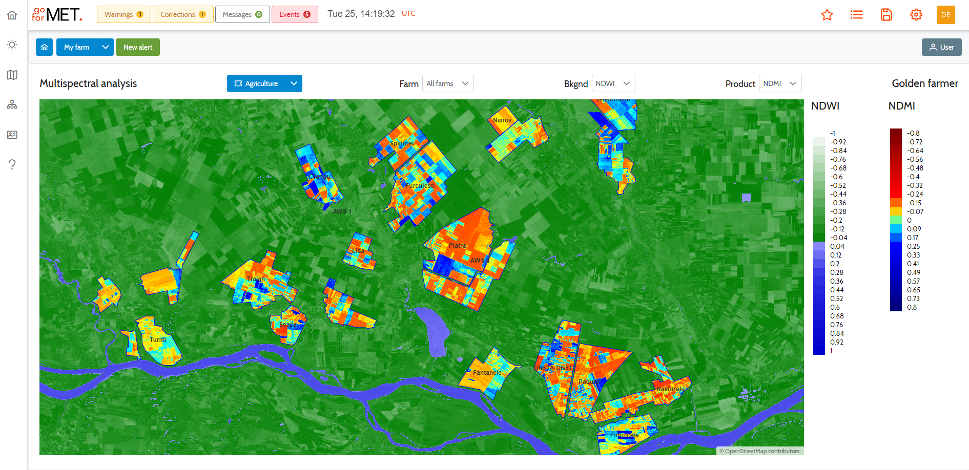
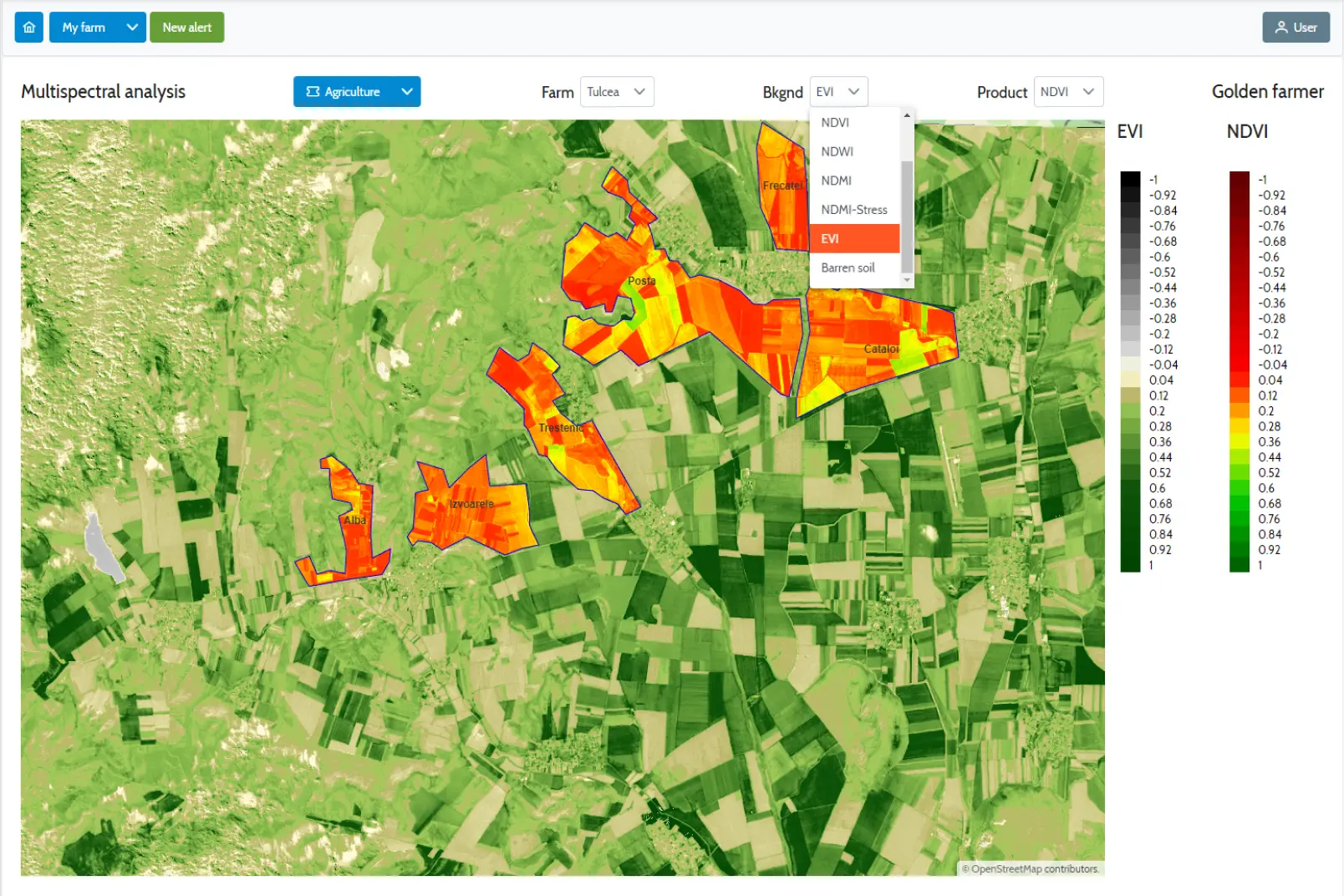
- monitors the health of the culture in almost real-time
We are keeping the farm owners informed, providing tools that allow them remotely to:
- check the crop growing status and the stage of agricultural work,
- compare the current parcel status with other ones nearby,
- compare the current crop status with the status existent in the same period of last year
On a subscription, which is much cheaper than several salaries for local supervisors, daily or monthly detailed reports can be provided.
Software modules
- User authentication, registration, subscription management, and user role management.
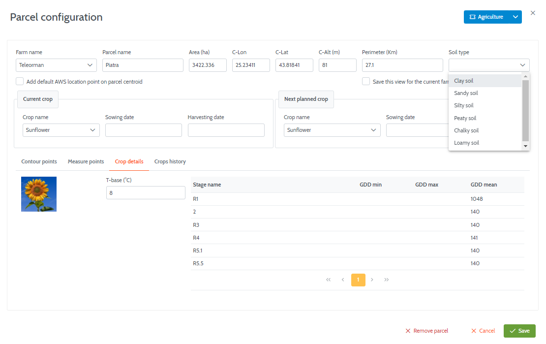
- Defining farms and parcels using a friendly graphical interface or importing georeferenced data.
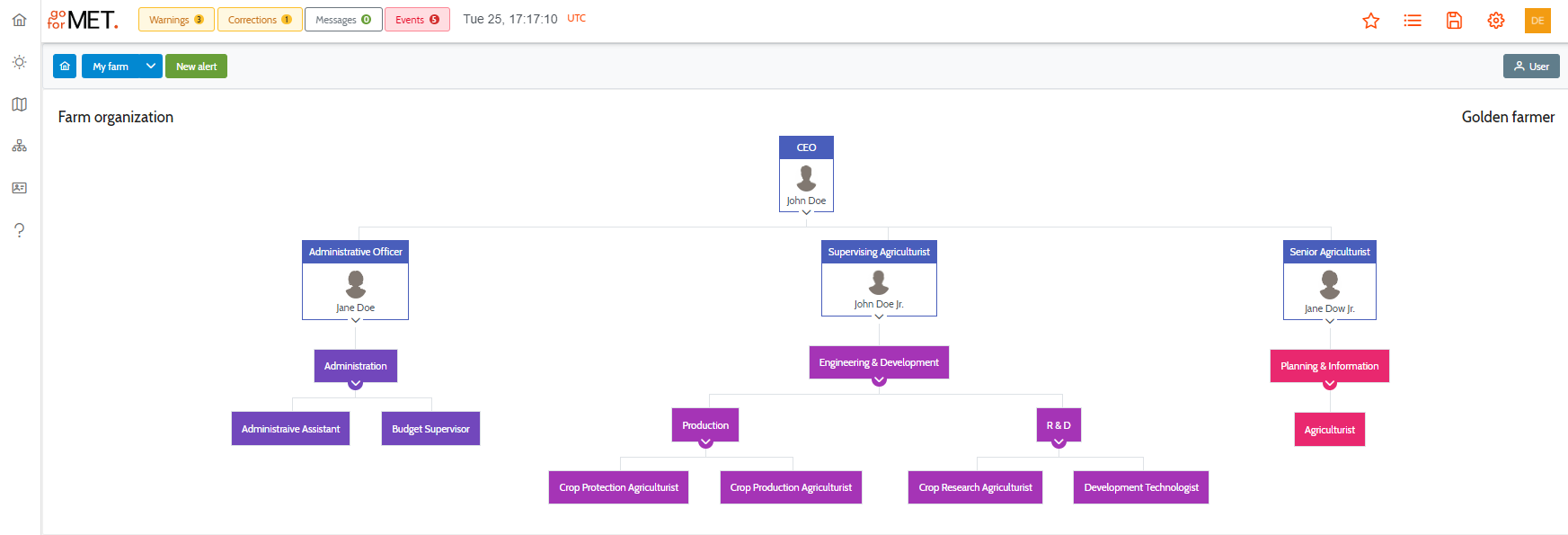
- Human resources management, monitoring, and control.
- Task scheduling
Easy-to-use graphical presentation in the form of maps, charts, and tables for all data provided as services by our SaaS system:
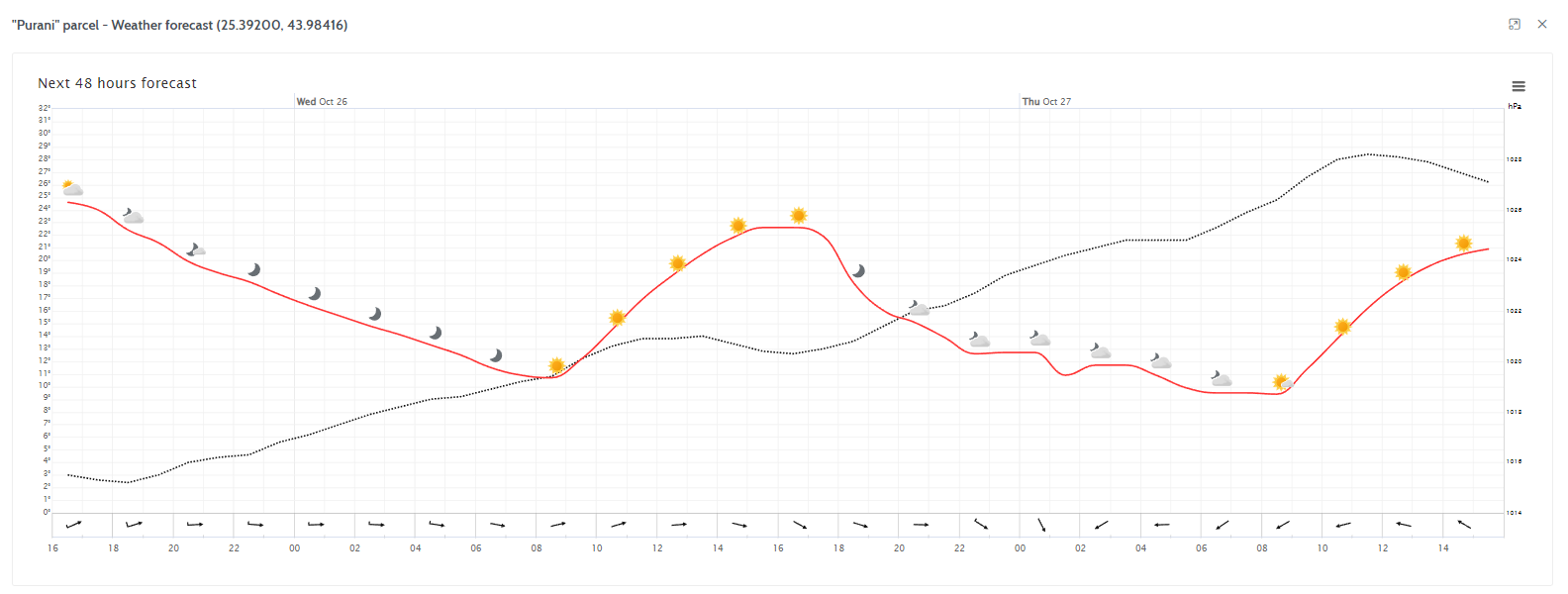
- Weather forecast for all customer locations of interest
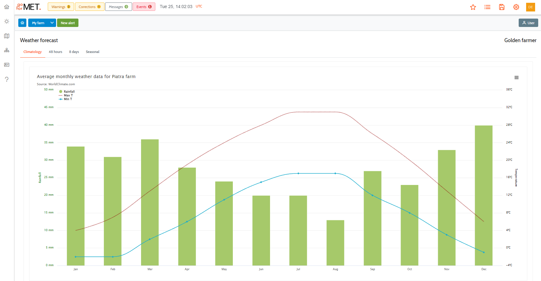
- Local climatology based on data processed from the last 30 years of archives
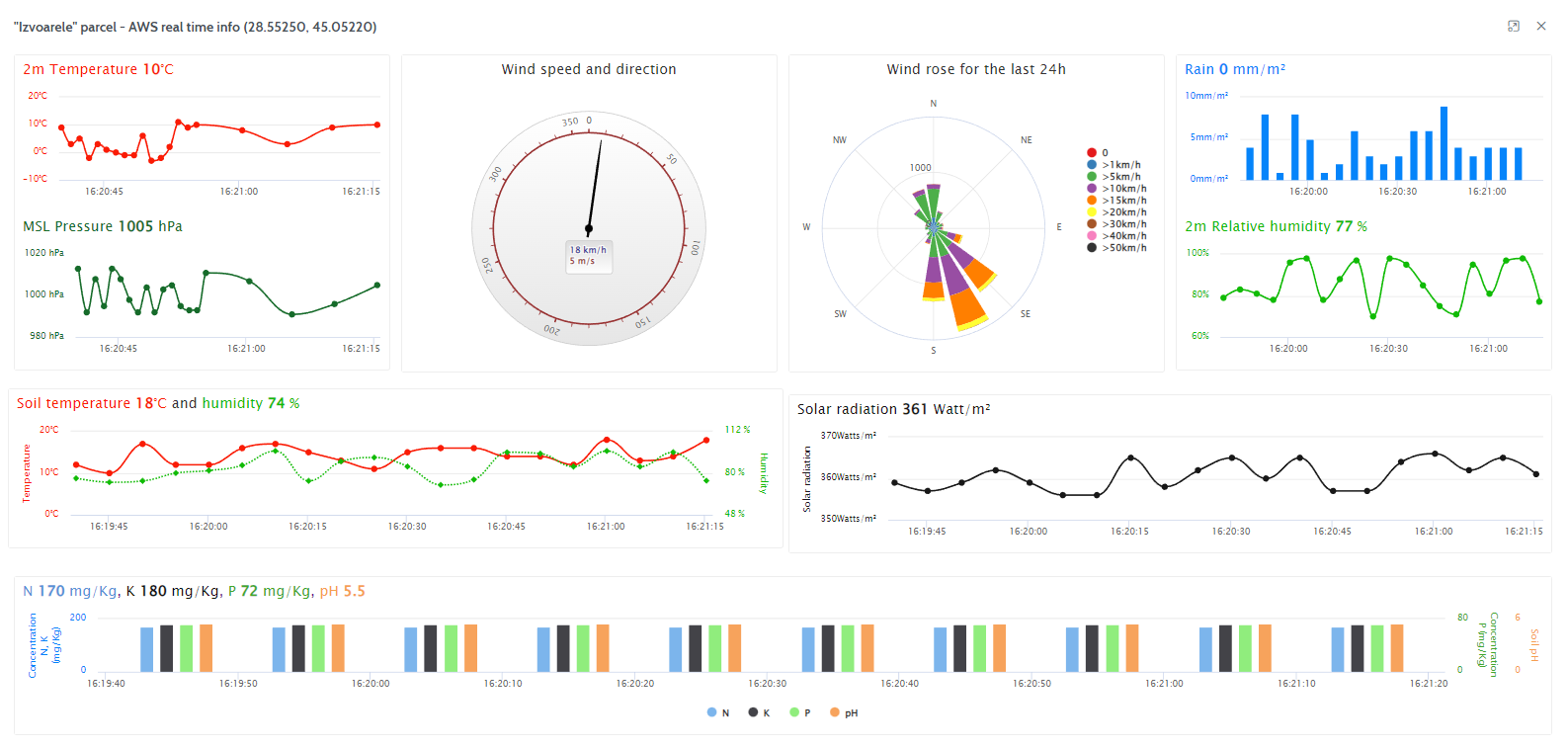
- Real-time monitoring of data collected from own weather stations and web cameras
- Very high-resolution end-user products are processed from multi-spectral images obtained from polar satellites and drones (if available). The data is analyzed using algorithms based on human expertise in the remote sensing data processing.
- Real-time alerts and early warnings are sent to our subscribers for damage control, indicating the likelihood of the occurrence of hazardous events and recommended preventive action.
- Crop history for all parcels, including sowing and harvesting time, yields and costs, comparison charts
- Online store for specific agricultural products
Integration of various third-party products using REST API:
- Management of leased parcels
- Multi-spectral analysis of images from drones
- Pest control by monitoring data from insect traps cameras using machine learning algorithms