
We produce on-demand near real-time processed images from Landsat and Sentinel polar satellites for any location in the world.
High Resolution Sattelite Images
Our specialists analyze the customer’s specific needs and extract only the related useful information. They choose the most suitable spectral bands to produce images as accurately as possible for the event of interest: structures damaged by an earthquake, conflict monitoring, floods, and vegetation fires.
Machine learning algorithms are used in data processing, but the final professional human expertise is essential in the process because any misinterpretation of the data can lead to the dissemination in the public area of false information, equivalent to fake news.
An annotation tool is available to transform the basic products into customer-oriented products, easy to understand by using a common language and explaining the benefits of each product in real life.
Remote sensing
There are several types of satellites that are used for weather and environment surveillance. These include:
- Geostationary satellites: These satellites are positioned in a fixed orbit above the Earth's surface, allowing them to constantly monitor the same area of the Earth's surface. They are typically used for long-term weather forecasting and monitoring.
- Polar-orbiting satellites: These satellites orbit the Earth from north to south, passing over both of the Earth's poles. They are used to provide global coverage of the Earth's surface and atmosphere, allowing for the monitoring of weather patterns and other environmental phenomena.
- Low Earth orbit satellites: These satellites orbit the Earth at altitudes of up to a few hundred kilometers. They are used for a variety of purposes, including weather monitoring, mapping, and communication.
- High-altitude balloon and drone systems: These systems are used to collect data and imagery from the Earth's surface and atmosphere. They can provide high-resolution imagery and other data for weather and environmental surveillance.
Overall, the specific type of satellite used for weather and environment surveillance depends on the specific goals and needs of the surveillance project. Different types of satellites offer different capabilities and advantages, and the best choice will depend on the specific requirements of the project.
Geostationary satellites imagery
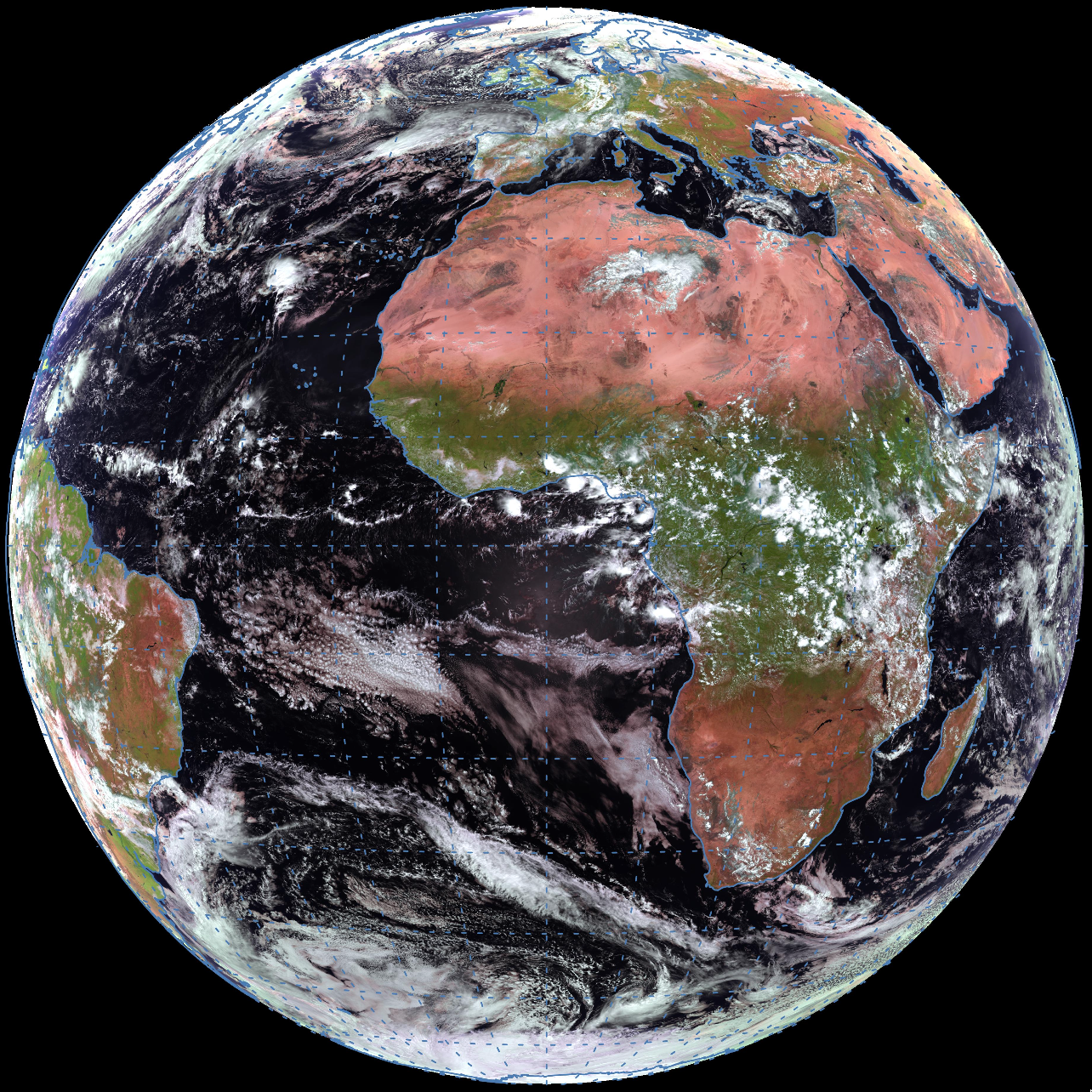
Geostationary satellites are satellites that orbit the Earth at an altitude of approximately 35,000 kilometers, and which remain in a fixed position relative to the Earth's surface. These satellites are often used for a variety of purposes, including weather prediction.
One of the key advantages of using geostationary satellites for weather prediction is their ability to provide a continuous, real-time view of the Earth's surface. Because they remain in a fixed position relative to the Earth's surface, geostationary satellites can provide a constant stream of data about the state of the atmosphere, including temperature, humidity, atmospheric pressure, and wind speed and direction.
This information can then be used by meteorologists and other weather experts to make more accurate and timely weather predictions. By combining data from geostationary satellites with other sources of weather data, such as ground-based observations and computer models, meteorologists can create detailed, up-to-date forecasts that can help people prepare for and respond to severe weather events.
In addition to their use in weather prediction, geostationary satellites are also used for a range of other purposes, including communications, navigation, and surveillance. Overall, these satellites are an important tool for understanding and predicting the Earth's weather and for supporting a range of other activities and services.
Polar satellites imagery

Polar-orbiting satellites are satellite systems that orbit the Earth from north to south, passing over both of the Earth's poles. These satellites provide important data and imagery for environmental surveys, as they allow scientists and researchers to study and monitor the Earth's surface and atmosphere.
One of the key benefits of using polar satellite imagery in environmental surveys is that it allows for the collection of data and imagery on a global scale. Because these satellites orbit the Earth in a polar path, they are able to capture images of every part of the Earth's surface, including areas that are difficult or impossible to access by other means. This allows scientists to study and monitor the Earth's environment on a comprehensive and continuous basis.
Polar satellite imagery is also useful for monitoring and studying specific environmental phenomena. For example, polar satellite images can be used to monitor the effects of climate change on the Earth's surface, including changes in vegetation, ice cover, and sea levels. They can also be used to study natural disasters, such as hurricanes and earthquakes, and to monitor the health of oceans, forests, and other critical ecosystems.
In addition to providing valuable data and imagery, polar satellite systems are also important for providing early warning of natural disasters and other environmental hazards. For example, polar satellites can detect the formation of hurricanes and other storms, allowing for early warning and evacuation efforts. They can also detect wildfires and other environmental disasters, allowing for timely response and mitigation efforts.
Overall, the use of polar satellite imagery in environmental surveys is an important tool for studying and monitoring the Earth's environment on a global scale. By providing comprehensive and continuous data and imagery, polar satellites help scientists and researchers to better understand the Earth's environment and to develop effective strategies for protecting and preserving it.