The Briefing module is a tool designed to provide users with information about the current state of the environment. It might include real-time data as well as historical data on factors such as air and water quality, weather conditions, climate change, and the health of local ecosystems.
GoForMet-Briefing
Individuals could use the GoForMet-Briefing module to learn about their local environment and make informed decisions about how to reduce their environmental impact, or organizations could use it to monitor and track the weather conditions and the health of their local area. The application could be accessed via a website or mobile and could provide real-time data as well as historical data to allow users to track changes over time.
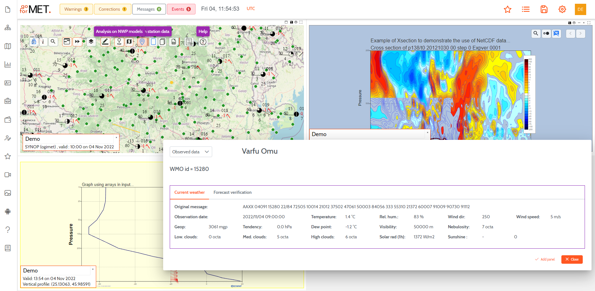
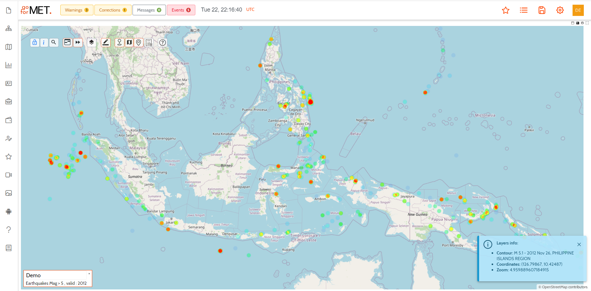
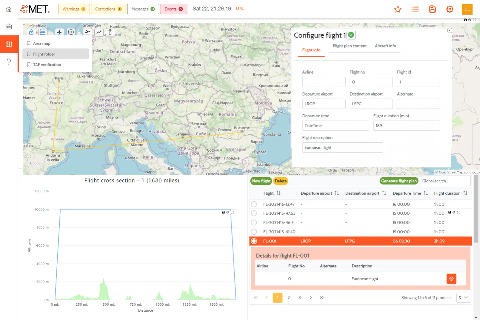
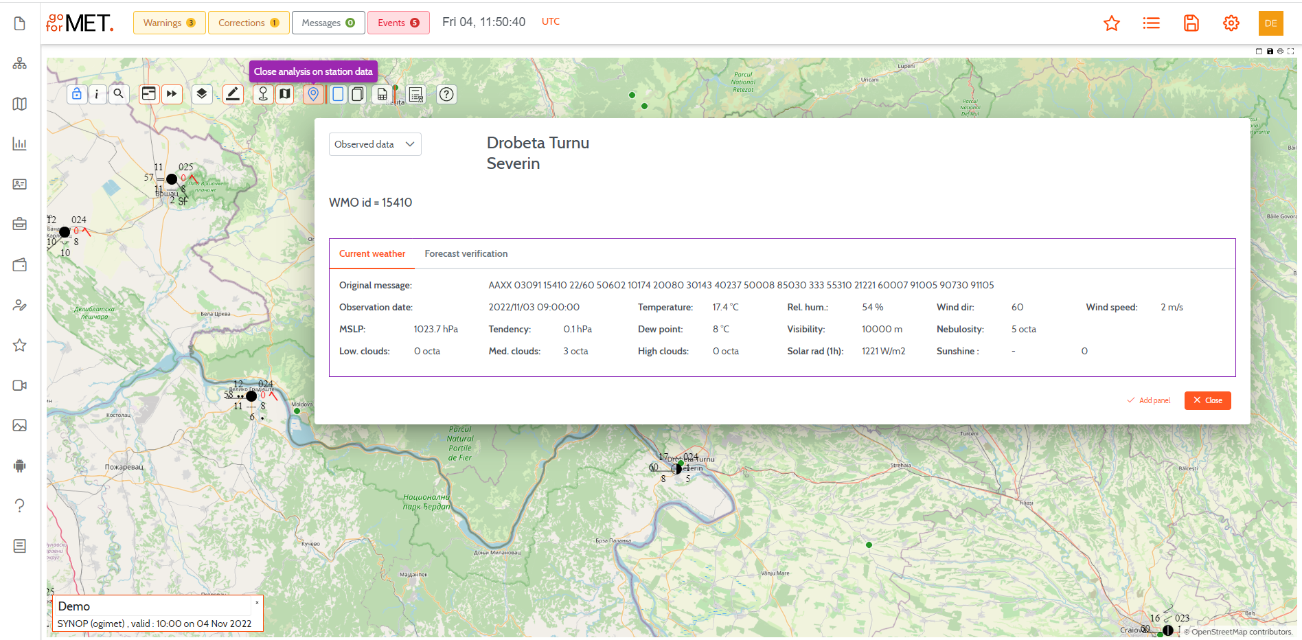
Different panels allow users to access and interact with different maps and charts in a single workspace. The panels might display current weather conditions, such as temperature, humidity, and precipitation levels, as well as forecasted weather for a specific location.
The data could be presented either in standard Bjerknes format or in clear language. The panels might also include information about local alerts and warnings, such as severe weather alerts or air quality warnings. They could be interactive, allowing users to view data for different locations or periods, and could also include visualizations, such as graphs or maps, to help users understand the data.
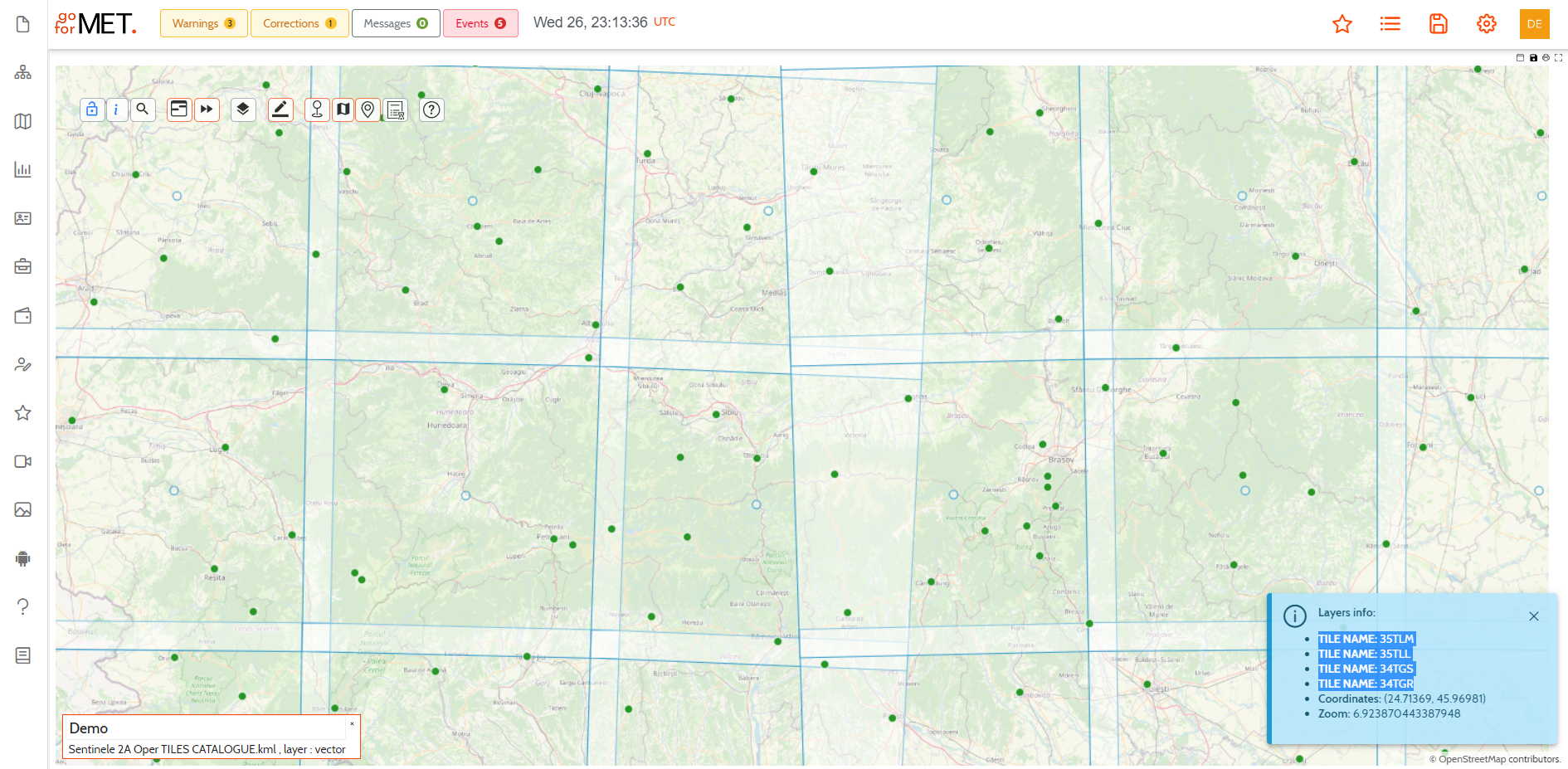
The Landsat and Sentinel satellites are part of a global network of satellites that are used to monitor and study the Earth's land, oceans, and atmosphere. These satellites are equipped with specialized sensors that are able to capture detailed images of the Earth's surface. One of the unique features of these satellites is their ability to produce on-demand, near real-time processed images for any location in the world. The combination of high-resolution imagery and rapid response times makes the Landsat and Sentinel satellites a powerful resource for understanding and managing the Earth's resources. The map below shows the tile coverage of Sentinel polar satellites for any location in the world.
GoForMet provides an HTTP interface for requesting geo-registered map images and vector or gridded data from one of the three geospatial databases (Operational Database, Long term Database, and Climate database). According to the data access policy, the system accepts requests only from registered users. A WMS, WFS, or WCS accepted request defines the geographic layer(s) and area of interest that will be processed, and in response, the geo-referenced object will be returned:
- geo-referenced images from WMS requests,
- vector, tabular, or time series data for WFS requests,
- irregularly distributed points or gridded data (NWP, climate models, analyzed data, or reanalysis) for WCS requests.
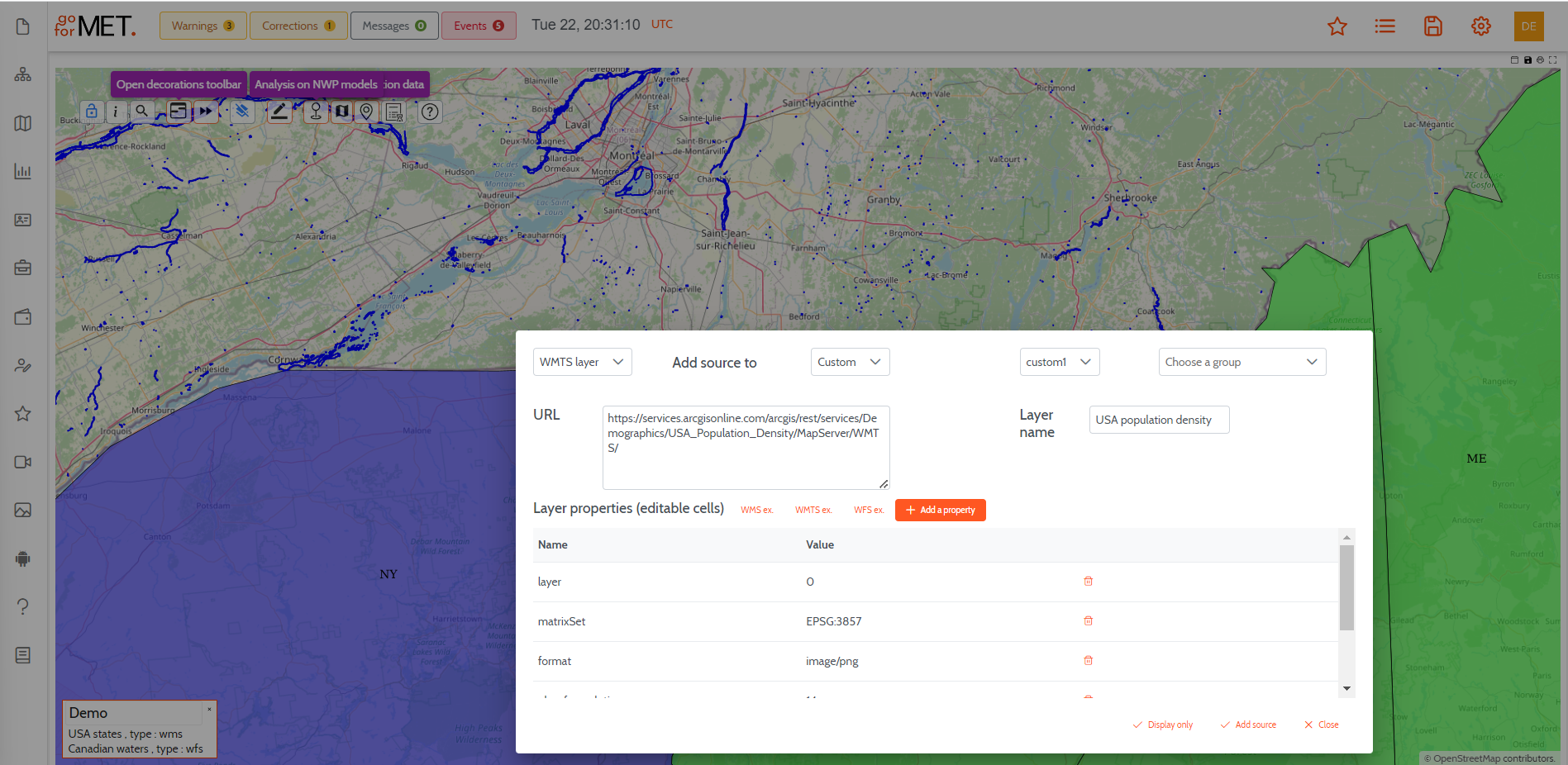
GoForMet implements the Open Layers to display geo-referenced data on the Client browser. This is an Open Source Geospatial Foundation (OSGeo) project that supports map data from any source that uses OGC standards such as WMS or Web Feature Service (WFS). It is extremely easy to configure the system to ingest any kind of OGC standard data and to display it instantly as a new overlay on top of any other data already displayed on a map.